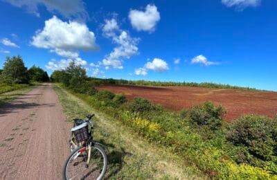


Cyclists will find a leisurely setting on the Lower Seymour Conservation Area, a popular path that’s open year round and is an easy drive from Vancouver. (Photo courtesy of Jeff Hitchcock)
Story by Tricia Edgar
Vacay.ca Outdoors Columnist
NORTH VANCOUVER, BRITISH COLUMBIA — This is the place where a mother bear and her cub graze by the side of the road, gazing at you as you walk past.
This is the place where a deer emerges from the salmonberry bushes and you stand perfectly still as it nibbles on the leaves a few metres away.
This is the place where masses of frogs sing in hidden forest ponds far off the trail as you ride by.
This is the place where you pause your riding to watch a mother grouse usher her babies across the path.
In North Vancouver’s Lower Seymour Conservation Reserve, visitors have the opportunity to go deep into the forests that surround Vancouver. While wildlife encounters like these don’t happen every day, this beaten path offers a bike, stroller, and wheelchair-accessible visit to a wilderness area.
While North Vancouver is world-renowned for its trail riding, the Lower Seymour offers a ride for those who’d like to explore in a quieter way. The trailway is ideal for families, and since it’s paved, it’s accessible to those who might not otherwise be able to visit many of North Vancouver’s wilderness areas.
As you make your way along the 11-kilometre trail, you’ll be surrounded by western red cedar, Douglas fir and hemlock rainforest, with snatches of mountain views. Along the trailway, you’ll discover stops every kilometre or two with picnic benches and washrooms, so you can bring a picnic lunch and make your adventure into a day trip. Around kilometre five, you’ll also find a trail down to an older road and into a sunny meadow with an amazing view of the North Shore mountains. Standing in that meadow, it’s hard to believe that you’re so close to a city centre. Instead, you hear the rush of the Seymour River far below.
At the top of the trailway, you’ll find the Seymour Dam, one of the dams that create Vancouver’s water reservoirs. Directly below the dam is the Seymour Hatchery, a fish-spawning facility that’s open for school tours. Near the hatchery, walking trails meander into a gorgeous forest with huge spruce trees and quiet side channels. Enjoy the peace of the forest’s smaller streams before you head back home on the trailway, winding your way through the peaceful forest on your way to more urban adventures.
Getting to Lower Seymour Conservation Reserve
The trail begins near the parking lot of the Lower Seymour Conservation Reserve. To get there by car, go across the Ironworkers’ Memorial Bridge on Vancouver’s east side and follow the signs toward Capilano University (exit 22A). Follow Lillooet Road past the university, through the cemetery, and through the forest until the road ends and you find the parking lot on your right. (See map below)
Finding a Bike for the Trail
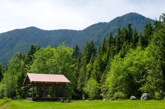
If you’re renting a ride, North Vancouver’s Endless Biking offers bike rentals for the day. Put your bike on the front of one of North Vancouver’s buses, and you’ll be on your way. The No. 210 Upper Lynn Valley bus goes from Endless Biking to Dempsey and Underwood near Rice Lake Road. If you’re bringing your own bike across on the Seabus or renting downtown, the No. 228 Lynn Valley bus runs from Lonsdale Quay next to the Seabus up to a stop just below Rice Lake Road. Bike down Rice Lake Road and across the Pipeline Bridge, and a short jaunt up the hill you’ll find a gazebo, washrooms, and the beginning of the bike trail.
Fall and Winter Visitors
If you’re visiting in the winter, be aware that the higher portions of the trailway can be icy and snowy even when the beginning is clear. Always pack your emergency gear as well. Although the trail is well-used during the summer, there are fewer people on it during the fall, winter and spring, and cell-phone reception is spotty in certain areas.
View Larger Map